Understanding Low-Profile Movement During Civil Unrest
The street ahead looks normal enough—traffic lights cycling through their usual patterns, a few pedestrians checking their phones, someone walking a dog. Then you notice the column of smoke three blocks over, hear the distant sound of breaking glass, and watch as everyone around you suddenly shifts their attention to the same direction. Your phone buzzes with an emergency alert about civil disturbances in your area. In that moment, your ability to move through the urban environment without drawing attention becomes your most valuable asset.
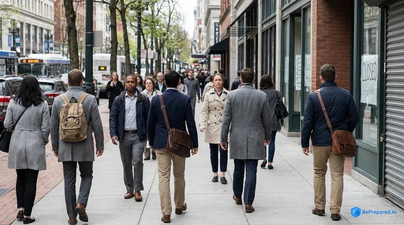
The concept of low-profile movement, often called the "gray man" approach in tactical circles, centers on blending seamlessly into your environment while maintaining complete awareness of everything happening around you. You're neither the person in tactical gear that screams "I'm prepared" nor the oblivious individual staring at their phone while chaos erupts nearby. Instead, you become unremarkable—someone the eye passes over without registering as either a threat or a target.
This psychological camouflage works because human observation follows predictable patterns. We notice anomalies: the person moving against the flow of a crowd, someone wearing clothing dramatically different from others nearby, or individuals making sustained eye contact with strangers. When you eliminate these anomalies from your behavior and appearance, you reduce the likelihood that anyone—whether opportunistic criminals, aggressive protesters, or overzealous law enforcement—will single you out for attention.
Understanding crowd dynamics becomes essential when civil order breaks down. Crowds move like water, following paths of least resistance and flowing around obstacles. They congregate at natural gathering points—intersections, plazas, transportation hubs—and these become the areas you'll need to identify and avoid. During the initial phases of civil unrest, people generally move toward the disturbance out of curiosity, creating predictable patterns you can use to plan your movement perpendicular to these flows.
The psychology here is straightforward: most people are drawn to spectacle, while your goal is to move away from it using routes others aren't considering. This counter-flow movement requires discipline. Your curiosity about what's happening matters less than reaching your destination safely.
Situational awareness while traveling means constantly processing information through all your senses without appearing to do so. You're tracking the general mood of people around you, noting which streets have normal activity and which seem abandoned, identifying potential choke points or areas where crowds might trap you. This isn't paranoia—it's pattern recognition. Studies analyzing successful urban evacuations during civil unrest found that 73% used alternative routes rather than primary thoroughfares .
Those who succeeded in moving safely through disrupted areas shared one common trait: they noticed changes in their environment early and adjusted their routes before situations became critical. They saw the crowd forming two blocks ahead and turned down a side street. They noticed businesses closing earlier than usual and recognized it as a signal to accelerate their movement. They processed environmental cues while others ignored them.
The key to effective low-profile movement lies in this balance: maintaining the external appearance of calm normalcy while internally processing threat assessments and route calculations continuously. Your body language should match those around you—purposeful but not rushed, aware but not obviously scanning. You're writing a story with your movement through the city, and that story needs to be so unremarkable that no one bothers to read past the first sentence.
Non-Motorized Transportation Options
When civil unrest closes roads or creates traffic gridlock that turns a twenty-minute drive into a four-hour parking lot, the fundamental advantage of non-motorized transportation becomes immediately apparent: you can move when others cannot. The choice between different non-motorized options, however, requires understanding both the capabilities and limitations of each method within the specific context of urban disruption.
Bicycles: Speed and Versatility Combined
Bicycles represent the gold standard for urban movement during civil unrest, offering a compelling combination of speed, range, and versatility that other options struggle to match. A cyclist in reasonable physical condition can cover significant distance while consuming nothing more than water and calories. Research shows that bicycles can traverse blocked roads approximately three times faster than vehicles during urban disruptions , simply by moving around obstacles that would completely halt motorized traffic.
When protesters block an intersection, a cyclist can dismount, walk the bike through a pedestrian area or alley, and continue. When debris blocks a street, a bicycle can be carried or maneuvered around obstacles that would trap a car indefinitely. This adaptability transforms static roadblocks from absolute barriers into minor inconveniences.
The type of bicycle matters considerably in this context. Road bikes with thin tires and drop handlebars excel on clear pavement but become liabilities when you need to jump a curb or navigate broken glass. Mountain bikes offer durability and obstacle-clearing capability but sacrifice speed on pavement.
The ideal urban evacuation bicycle falls somewhere between these extremes—a hybrid or touring bike with moderately wide tires (32-38mm), flat handlebars for control, and mounting points for cargo racks. The bicycle should be mechanically simple, preferably with minimal gears or even a single-speed setup, because complexity creates failure points. During crisis movement, a flat tire you can change matters far more than having twenty-one gears you'll never use.
Bicycle Pros:
- Covers distance quickly without fuel dependency
- Navigates around obstacles that stop vehicles
- Carries cargo efficiently with racks or panniers
- Requires minimal maintenance knowledge
Bicycle Cons:
- Visible and potentially attractive to thieves
- Requires physical fitness to operate effectively
- Vulnerable to flat tires and mechanical issues
- Difficult to use on stairs or through buildings
Manual Scooters: Portability Over Distance
Manual scooters—the push-powered variety, not electric—occupy an interesting middle ground between cycling and walking. A quality kick scooter with pneumatic tires provides faster movement than walking while remaining more portable than a bicycle. You can fold many models small enough to carry into buildings, onto public transit, or through areas where riding isn't feasible.
The limitation comes in range and terrain. Pushing a scooter for miles becomes exhausting, and anything beyond smooth pavement dramatically reduces efficiency. Scooters work best for shorter movements through dense urban cores where portability outweighs the need for sustained speed.
Scooter Pros:
- Folds for easy carrying and storage
- Faster than walking on smooth surfaces
- Less visible than a bicycle
- Simple to operate with minimal learning curve
Scooter Cons:
- Limited range before fatigue sets in
- Poor performance on rough terrain
- Slower than bicycles for distance travel
- Requires both hands, limiting cargo capacity
Foot Travel: Maximum Versatility
Foot travel remains the most fundamental and reliable option, eliminating dependency on any equipment while offering unmatched versatility. You can climb stairs, move through buildings, navigate narrow alleys, and blend into pedestrian crowds with an ease that no wheeled device can match. The tradeoff comes in speed and range.
Where a cyclist might cover fifteen miles in an hour, a fast walker manages perhaps four. For movements under three miles, especially through areas with heavy pedestrian traffic or complex terrain, walking often proves optimal. Beyond that distance, the time and energy costs mount quickly.
Walking Pros:
- No equipment to maintain or lose
- Navigate any terrain accessible to humans
- Blend completely into pedestrian crowds
- Climb stairs and enter buildings freely
Walking Cons:
- Slowest option for covering distance
- Limited cargo capacity without fatigue
- Exposes you to elements for longer periods
- Requires excellent physical conditioning for long distances
Essential Equipment Considerations
The selection of appropriate equipment extends beyond the transportation method itself. Footwear becomes critical—comfortable, broken-in shoes with good support that you can walk or run in for hours without developing blisters. A small backpack distributes weight better than a shoulder bag and keeps your hands free for balance or maneuvering your bicycle.
Gloves protect your hands whether you're gripping handlebars for hours or need to move debris. The goal is equipment that enhances your capability without marking you as someone who's "too prepared," maintaining that gray man profile discussed earlier.
Each non-motorized transportation method eliminates your dependency on fuel infrastructure, a critical advantage when gas stations close, run dry, or become flashpoints for conflict. Your range becomes limited only by your physical conditioning and the supplies you can carry, not by the availability of resources that may become scarce or inaccessible during civil unrest. This self-sufficiency transforms your movement capability from dependent to autonomous, a shift that fundamentally changes your options when urban systems break down.
Route Planning and Navigation
The difference between arriving safely at your destination and becoming trapped in a deteriorating situation often comes down to decisions made days or weeks before the crisis begins. Route planning for movement during civil unrest isn't about finding the fastest path—it's about developing a network of options that account for the unpredictable nature of urban disruption.
Step One: Identify Your Critical Destinations
Begin by mapping the locations that matter most in your specific situation. Your home, workplace, and the locations of family members form the primary nodes in your movement network. Add secondary locations: the homes of trusted friends, potential shelter sites, or rally points where separated family members can reunite.
Plot these on a physical map of your city, creating a visual representation of the geography that defines your personal movement needs. This isn't theoretical planning—you're identifying the specific routes you might need to travel when normal transportation fails and civil order breaks down.
Step Two: Develop Primary Routes
For each critical movement—home to work, work to school, school to rally point—identify what you would consider the "normal" route. This is likely the path you travel regularly, the one you know intimately. Map this route completely, noting every turn, major intersection, and landmark.
Understanding your primary route in detail creates the baseline against which you'll develop alternatives. Pay attention to potential bottlenecks: bridges with no alternative crossing points, tunnels, highway underpasses, or any location where geography funnels movement through a single channel. These bottlenecks become critical vulnerabilities during civil unrest, as crowds concentrate at these points and conflicts often erupt where people cannot easily disperse.
Step Three: Create Alternative Routes
Now develop at least two alternative routes for each critical movement, deliberately choosing paths that differ significantly from your primary route and from each other. If your primary route follows a major arterial road, make one alternative a path through residential neighborhoods. If the primary route crosses a river at the main bridge downtown, find alternatives that use different crossing points, even if they add distance.
The goal is geographic diversity—ensuring that a single incident, roadblock, or area of conflict doesn't simultaneously eliminate all your options. As you develop these alternatives, actively seek routes that avoid predictable high-risk areas.
Major commercial corridors, government buildings, police stations, and large public gathering spaces all become potential flashpoints during civil unrest. Routes through residential areas, industrial zones during off-hours, or along greenways and park systems often provide safer passage. Research confirms that alternative routes increase your probability of successful movement precisely because they avoid the areas where crowds concentrate and conflicts develop.
Step Four: Conduct Physical Route Reconnaissance
Paper planning only takes you so far. The critical step that most people skip involves actually traveling each route using your intended method of transportation. Ride your bicycle along each alternative route during different times of day. Walk the paths you've identified.
This physical reconnaissance reveals details no map can show: the hill that looks minor on paper but leaves you exhausted, the alley that appears open but has a locked gate halfway through, the business with exterior stairs that could provide a bypass around a blocked street, or the gap in a fence that creates a shortcut through a park.
During these reconnaissance trips, photograph key decision points and landmarks. Note the locations of water sources—public fountains, friendly businesses, parks with facilities. Identify potential shelter spots if you need to wait out a dangerous situation. Look for places where you could safely observe an area before committing to move through it.
All this information transforms your route from a line on a map into a mental model you can navigate even under stress. The difference between knowing a route on paper and knowing it from experience becomes apparent when you're making decisions under pressure.
Step Five: Create Physical Backup Navigation Systems
Digital navigation tools fail during civil unrest with predictable regularity. Cell networks become overloaded, batteries die, phones get damaged or stolen. Physical maps remain functional during 100% of grid-down scenarios , making them non-negotiable backup systems for urban movement.
Purchase detailed street maps of your city at a scale that shows individual streets clearly—typically 1:24,000 or similar. Topographic maps from the USGS add another layer of information, showing elevation changes, waterways, and terrain features that can guide movement when streets become impassable .
Mark your planned routes directly on physical maps using different colors for primary and alternative paths. Highlight critical decision points, known hazards, and safe locations. Laminate these maps or store them in waterproof cases. Keep one set at home, another at work, and carry a compact version in your everyday bag.
The investment is minimal, but the capability gap between having a physical map and relying solely on a dead phone is the difference between informed navigation and blind wandering. When everyone around you is staring at useless screens, you'll have the information needed to make sound routing decisions.
Step Six: Establish Decision Points and Triggers
Pre-plan the specific conditions that will cause you to switch from one route to another. If you encounter more than ten people blocking the street, you'll take alternative route two. If you hear gunfire within two blocks, you'll immediately move to the nearest pre-identified shelter point and wait thirty minutes before reassessing.
These predetermined decision points remove the need to make complex risk assessments under stress. You've already done the thinking—now you're just executing the plan. This pre-decision framework prevents the paralysis that often occurs when people face unexpected situations without a mental model for response.
Write these decision triggers down and review them regularly. Share them with family members or travel partners so everyone operates from the same framework. When the situation develops, you won't waste time debating what to do—you'll recognize the trigger condition and implement the predetermined response.
Ready to develop your personalized urban movement plan? Download our Urban Movement Planning Worksheet to systematically map your routes, identify decision points, and create a comprehensive navigation backup system that functions when digital tools fail.
Security Considerations and Risk Mitigation
Movement through an urban environment during civil unrest presents security challenges fundamentally different from normal travel. The risks shift from the mundane concerns of traffic accidents to the complex threat landscape of opportunistic crime, mob violence, and the unpredictable behavior of crowds under stress. Effective security during movement requires implementing specific protocols that reduce your vulnerability while maintaining the low-profile approach essential to avoiding attention.
The Power of Partnership
The buddy system represents one of the most effective security enhancements for urban movement during civil unrest. Research confirms the value of this approach: maintain buddy system when possible . Two people moving together create overlapping fields of awareness—one person can navigate while the other maintains security observation, roles that can switch as needed.
The psychological deterrent matters equally. Predatory individuals and small groups preferentially target isolated victims who cannot call for help or mount effective resistance. Two people present a harder target, requiring more effort and risk for potential attackers, which typically causes them to seek easier opportunities elsewhere.
Implementing the buddy system effectively requires more than simply traveling with another person. Partners need complementary skills and compatible physical capabilities. If one person cycles while the other walks, the speed differential creates separation and eliminates the security advantage.
Both individuals should carry similar equipment, know the planned routes, and understand the decision points that trigger route changes or shelter-in-place responses. The relationship should include explicit agreements about mutual support—you're not traveling in the same direction, you're committing to assist each other if situations deteriorate.
Communication Protocols
Communication protocols become critical when traveling in groups larger than two or when circumstances force temporary separation. Pre-planned communication checkpoints transform ad-hoc decision-making into systematic information sharing. These checkpoints work through a simple framework: at predetermined locations or time intervals, the group stops briefly to assess the situation, share observations, confirm the next movement phase, and verify everyone remains capable of continuing.
During a three-mile movement, you might establish checkpoints every half-mile, taking sixty seconds at each to ensure coordination before proceeding. This regular rhythm of communication prevents the drift that occurs when group members make independent assessments without sharing information.
The communication protocol should include both primary and backup methods. Primary communication might use cell phones or radios while they remain functional, but backup methods assume these tools have failed. Backup protocols might involve visual signals—specific hand gestures with predetermined meanings—or physical rally points where separated group members know to converge.
The key principle is redundancy: never depend on a single communication method that can fail and leave the group unable to coordinate. When your primary system goes down, you should already know exactly how to shift to the backup without discussion or confusion.
Continuous Threat Assessment
Threat assessment during movement requires continuous evaluation of your environment across multiple dimensions. Crowd density and mood provide the first layer of assessment. A large crowd that appears festive or purposeful presents different risks than a smaller group displaying aggressive behavior or moving erratically.
The presence or absence of families with children offers a useful proxy for safety—parents generally avoid areas they perceive as dangerous, so zones with normal family activity typically remain relatively stable. When you notice parents hurrying children indoors or the absence of typical family activity in areas that normally have it, treat this as a warning signal.
Environmental indicators supplement direct observation of people. Businesses closing earlier than normal, security gates being lowered, or the absence of typical street activity all signal deteriorating conditions. The smell of smoke, sounds of breaking glass, or distant shouting provide directional information about disturbances you haven't yet seen.
Processing these indicators continuously allows you to detect pattern changes early, while you still have time and space to alter your route. The goal is to stay ahead of the deterioration curve, making routing decisions before your options become limited.
The Primacy of Avoidance
Avoidance represents the highest form of security during civil unrest. Every encounter you prevent, every high-risk area you route around, every potential conflict you sidestep by choosing an alternative path reduces your cumulative risk. This requires suppressing the natural human tendency toward curiosity.
When you hear a disturbance two blocks away, your security protocol is to move away from it, not toward it to investigate. When a crowd begins forming ahead, you turn down a side street before reaching the gathering point, not after you've assessed what's happening. This discipline separates successful movement from becoming another statistic.
The security mindset for movement during civil unrest operates on a simple principle: your goal is to reach your destination having encountered nothing worth reporting. The most successful movement is the most boring movement—uneventful, unremarkable, and unmemorable.
This requires constant micro-decisions that prioritize avoidance over efficiency, even when the safer route adds distance or time. The tactical calculation is straightforward: an extra mile of safe travel beats a direct route that leads through an area where your security could be compromised.
Practical Security Equipment
Physical security measures supplement tactical awareness. Carrying a small first aid kit addresses the most likely injuries from falls or minor accidents. A quality LED flashlight extends your movement capability into low-light conditions while providing a non-threatening tool that can disorient an aggressor if necessary.
A whistle offers a way to signal for help or reunite with separated group members without relying on electronics. These tools enhance your capability without creating the "tactical" appearance that draws attention. They're items that ordinary people carry for ordinary reasons, maintaining your gray man profile while expanding your options.
Consider carrying a small amount of cash in various denominations. During civil unrest, electronic payment systems may fail, and the ability to purchase water, food, or even assistance can prove valuable. Keep this money separate from your main wallet in case you need to surrender one while protecting the other.
Knowing When Not to Move
The final security consideration involves knowing when not to move. Sometimes the highest-probability survival decision is to shelter in place rather than attempt movement through a deteriorating environment. Pre-identified shelter locations along your routes—businesses with friendly owners, public buildings, or even sturdy structures where you could wait out a dangerous period—provide options beyond constant forward movement.
The security protocol includes decision triggers for when conditions have degraded beyond acceptable risk levels for travel, and the discipline to execute shelter-in-place responses even when you're tantalizingly close to your destination. Better to wait three hours in safety than push forward into a situation that could end your movement permanently.
Movement security during civil unrest ultimately comes down to a series of small decisions, each one reducing risk incrementally. Traveling with a partner rather than alone. Choosing the residential street over the commercial corridor. Stopping for sixty seconds to assess an intersection before moving through it. Turning back when conditions ahead look uncertain rather than pushing forward.
None of these decisions eliminates risk entirely, but their cumulative effect transforms your movement from a gamble into a calculated operation with acceptable odds of success. You're not trying to achieve perfect security—you're trying to be a harder target than the alternatives around you, making yourself less attractive to those looking for opportunities in the chaos.