Understanding Urban Transportation Risks During Civil Unrest
When protests erupted in downtown Minneapolis in 2020, Sarah Chen found herself stranded twelve miles from home after the metro system shut down with only fifteen minutes' warning. Her usual forty-minute commute transformed into a six-hour ordeal navigating unfamiliar neighborhoods on foot, avoiding areas where tensions ran high. Sarah's experience illustrates a reality that urban dwellers increasingly face: civil unrest doesn't just disrupt traffic—it can completely dismantle the transportation networks millions depend on daily.
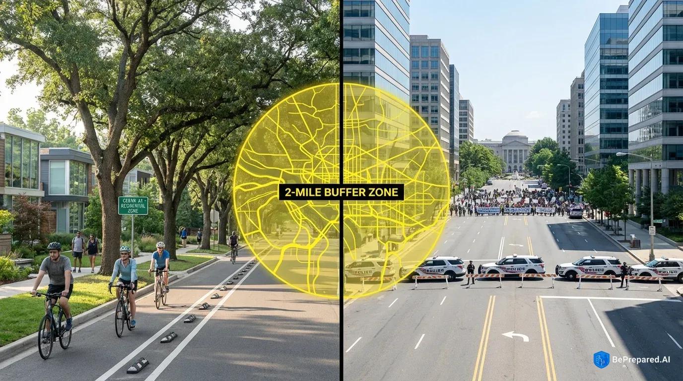
Public transit systems operate under strict safety protocols during periods of civil unrest, and these protocols often mean sudden, widespread service suspensions. Transit authorities typically suspend service within two miles of active protest areas . This buffer zone exists for good reason—protecting both passengers and transit workers from potential harm—but it creates ripple effects throughout entire metropolitan areas. A single protest zone in a city's downtown core can render dozens of bus routes, subway lines, and light rail services temporarily inoperable. The Department of Transportation's emergency response protocols confirm that these shutdowns often occur with minimal advance notice, sometimes as little as thirty minutes before service cessation .
Research shows that 73% of studied cities experienced significant disruption to public transit during civil unrest . These aren't isolated incidents affecting a few unlucky commuters. When a major metropolitan transit system goes dark, hundreds of thousands of people suddenly need alternative ways to reach safety, home, or family members. The scale of these disruptions means you can't rely on luck or assume someone else will help you navigate the chaos.
The temporal dimension of these disruptions deserves careful consideration when developing your preparedness strategy. Some incidents resolve within hours, while others extend for weeks. The 2020 protests across multiple U.S. cities saw transportation disruptions ranging from single-day closures to service modifications lasting nearly two weeks in certain corridors. This variability means you can't simply wait out the disruption in most cases—you need functional alternatives ready to deploy immediately.
Understanding which areas face the highest risk helps you anticipate problems before they materialize. Downtown commercial districts, government building complexes, and major public squares typically serve as focal points for demonstrations. Transportation hubs themselves—major subway stations, bus terminals, and transit centers—often fall within affected zones even when they're not the intended gathering points. The RAND Corporation's research on urban mobility during social disruption identifies a pattern where arterial roads connecting downtown areas to residential neighborhoods experience secondary effects, including spontaneous road closures, heavy traffic congestion from diverted vehicles, and reduced police response capacity .
These secondary impact zones can spread well beyond the primary protest areas, effectively creating transportation challenges across significant portions of a metropolitan region. A demonstration downtown doesn't just affect downtown—it radiates outward, closing highways, jamming surface streets, and overwhelming alternative routes as thousands of people simultaneously seek ways around the disruption.
The cascading nature of urban transportation disruptions compounds individual challenges. When subway service stops, thousands of commuters simultaneously shift to alternative methods—rideshare services, taxis, buses on unaffected routes, or personal vehicles. This surge overwhelms remaining transportation options within minutes. Rideshare pricing algorithms respond to demand spikes with surge multipliers that can reach five to ten times normal rates. Roads become parking lots as vehicle traffic concentrates on fewer available routes. Even walking becomes complicated when sidewalks fill with crowds moving in multiple directions, some evacuating areas while others approach to observe or participate in demonstrations.
The psychological dimension matters too. Uncertainty about when service will resume, whether your chosen route remains safe, and how long your journey might take creates stress that impairs decision-making. People make poor choices under pressure—taking unnecessary risks, following crowds into dangerous areas, or freezing up when action is needed. Your preparation today reduces that pressure tomorrow, giving you clear protocols to follow when others are panicking.
Planning Alternative Transportation Methods
The comparison between transportation options during civil unrest reveals stark differences in reliability, safety, and practicality. While your daily commute might rely heavily on public transit or personal vehicles, periods of social disruption fundamentally alter the calculus of what works best. Understanding these differences before crisis situations develop allows you to build robust backup systems rather than improvising under pressure.
Bicycles emerge as the standout alternative during urban civil unrest, and the data supporting this conclusion is compelling. Bicycle usage increased 312% during civil unrest periods in studied cities . This dramatic surge reflects several inherent advantages bicycles offer in disrupted environments. Unlike vehicles, bicycles navigate around traffic blockades, utilize bike lanes and paths that remain accessible when roads close, and require no fuel beyond human energy. A cyclist can typically maintain route flexibility that motorists lose entirely when roads shut down.
Where a driver might face a complete dead-end at a police barricade, a cyclist can often dismount, walk the bike through pedestrian areas, and resume riding on the other side of the obstruction. This adaptability proves invaluable when conditions change rapidly and your planned route suddenly becomes impassable.
Comparing bicycles to foot travel reveals why wheels matter even at slower speeds. Walking three miles through an urban environment might require sixty to ninety minutes for most people, while cycling the same distance takes fifteen to twenty minutes. This time compression becomes critical when you're trying to clear an area where tensions are escalating. The ability to cover distance quickly while maintaining awareness of your surroundings—something difficult in a car moving at speed—gives cyclists a tactical advantage. You can hear what's happening around you, make immediate directional changes, and access your phone for navigation or communication without pulling over.
Research confirms that walking remained the most reliable form of transportation within a 3-mile radius of conflict zones . For shorter distances, your own two feet provide unmatched reliability. No mechanical failures, no fuel requirements, no dependency on infrastructure. Walking lets you take shortcuts through parks, alleys, and pedestrian passages that vehicles can't access. You blend into crowds when needed or take isolated paths when that seems safer.
However, bicycle reliance requires advance preparation that many urban residents overlook. If you don't regularly cycle, suddenly deciding to bike home during an emergency introduces new risks. Unfamiliarity with bike handling in traffic, lack of knowledge about which streets have bike infrastructure, and simple physical conditioning all become factors. The comparison here is between preparation and improvisation: a person who occasionally bikes for recreation and knows their city's bike network will navigate disruption far more successfully than someone borrowing or renting a bike for the first time during a crisis.
Start building your cycling capability now, even if you don't plan to bike regularly. Ride your potential emergency routes on weekends. Learn which streets have protected bike lanes, which neighborhoods have calmer traffic, and where the dangerous intersections lurk. Build the muscle memory and cardiovascular conditioning so that a ten-mile emergency ride feels challenging but achievable, not impossible.
Carpooling networks represent another alternative worth developing before you need them urgently. These informal systems work best when established through existing social connections—coworkers living in similar areas, neighbors who work in the same district, or community groups with overlapping travel patterns. The key difference between emergency carpooling and casual arrangements is the establishment of clear protocols: designated meeting points away from your home address, communication channels that work when cellular networks become congested, and pre-agreed decision criteria for when to activate the carpool versus using individual alternatives.
Safe meeting points deserve particular attention in carpool planning. Your workplace parking lot might seem obvious, but if civil unrest affects the downtown area where you work, that lot could be inaccessible or unsafe. Instead, identify locations outside typical protest zones—shopping center parking lots in residential areas, park-and-ride facilities on the urban periphery, or even residential streets in quiet neighborhoods where multiple people can safely gather. The comparison between central and peripheral meeting points often means the difference between successful coordination and failed rendezvous attempts.
Build these networks through deliberate conversation, not assumption. Talk with your coworkers about where they live and what routes they take. Identify overlap and discuss whether mutual assistance makes sense. Exchange contact information and establish a simple communication protocol: "If transit goes down and I text 'need ride,' can you pick me up at the Safeway on Miller Road?" Get explicit agreement, not vague "yeah, probably" responses that evaporate when actual crisis hits.
Emergency bike-sharing programs have demonstrated 80% effectiveness in crisis situations . Cities including Washington D.C., New York, and San Francisco have documented cases where bike-share systems remained operational during transit shutdowns, offering residents and visitors a functional alternative. These systems offer advantages over personal bicycle ownership for some users—no storage concerns, no maintenance requirements, and the ability to make one-way trips without worrying about bike security at the destination.
However, bike-share systems face their own disruption risks. Stations located in protest zones become inaccessible. High demand can deplete bikes from certain stations entirely. Payment systems sometimes fail when cellular networks become overloaded. Vandalism or deliberate sabotage can take stations offline. Don't treat bike-share as your only option, but include it in your toolkit of alternatives.
The most resilient approach combines multiple methods rather than depending on any single alternative. Someone who owns a bicycle, maintains an active bike-share membership, participates in a carpool network, and keeps a good pair of walking shoes at the office has effectively created redundancy. When one system fails, others remain available. This multi-modal preparation mirrors how experienced urban operators think about transportation—not as a single solution but as a toolkit of options deployed based on current conditions.
Pros and Cons of Primary Alternative Transportation Methods:
Bicycles:
- Pros: Fast coverage of medium distances, route flexibility, no fuel needs, can navigate around obstacles, maintains situational awareness
- Cons: Requires physical fitness, needs advance practice, vulnerable to mechanical failure, limited cargo capacity, weather exposure
Walking:
- Pros: Maximum reliability, no equipment failure risk, complete route flexibility, blends into crowds, works in all conditions
- Cons: Slow speed limits distance, physically demanding for long trips, exposure to elements, limited cargo capacity
Carpooling:
- Pros: Covers long distances quickly, weather protection, cargo capacity, shared fuel costs, safety in numbers
- Cons: Depends on vehicle access, vulnerable to road closures, requires coordination, traffic congestion, parking challenges
Bike-Share Systems:
- Pros: No ownership burden, one-way trips possible, widely distributed, no maintenance needs, quick access
- Cons: Station availability varies, payment system dependency, high demand depletes supply, stations in protest zones inaccessible
Route Planning and Safety Protocols
Developing your route planning strategy begins with mapping your essential destinations and the various paths connecting them. Start by identifying the locations you absolutely must reach during a crisis: your home, your workplace, your children's schools or daycare facilities, the homes of elderly relatives requiring care, and your primary medical facilities. These points form the foundation of your transportation network during disruption.
For each critical destination pair—home to work, work to school, school to elderly parent's home—you need to chart at least three different path options. Alternative routes should include at least three different path options to ensure you maintain mobility even when multiple corridors face closure . The first route should represent your optimal path under emergency conditions, prioritizing safety and distance from likely protest areas over speed or convenience. This route might take you through residential neighborhoods rather than commercial districts, add miles to avoid downtown areas, or utilize paths that feel circuitous under normal circumstances but offer better security during unrest.
Your second route serves as the primary backup, ideally sharing minimal overlap with the first option. If your optimal route travels north around a downtown core, your backup might arc south, creating geographic separation between the two paths. This separation ensures that a single protest area or roadblock doesn't simultaneously eliminate both options. Map this second route with the same detail as the first, noting landmarks, turn-by-turn directions, and key decision points where you'll assess which route to take based on current conditions.
The third route should represent your contingency plan for worst-case scenarios—the path you'll take if both primary routes become impassable. This might involve significantly longer distances, areas you're less familiar with, or routes that require multiple transportation modes. For instance, your third route might involve biking to a suburban transit station outside the affected area, then using commuter rail to reach a point where you can safely resume biking. The complexity of contingency routes makes pre-planning essential; trying to improvise these complicated alternatives while under stress rarely succeeds.
When mapping your paths, identify known gathering points in your city—government buildings, major public squares, historically significant protest locations, and large public parks. Your planned routes should avoid these areas whenever possible, even if doing so requires significant detours. The two-mile buffer zone that transit authorities use provides a useful guideline for your own planning, though conditions vary and some situations require even wider margins.
Understanding that protest locations can emerge spontaneously requires building flexibility into your route planning. A demonstration might begin at a permitted location but move to other areas as it progresses. Police response activities can create new zones of disruption separate from the original protest site. This dynamic nature of civil unrest means your route planning can't simply avoid known points—you need decision trees that help you adapt in real-time.
Create decision points along each route where you'll assess conditions before proceeding. These checkpoints might be intersections where you can observe the next mile of your planned path, locations with good cellular coverage for checking news updates, or spots where you can safely communicate with others about conditions ahead. At each decision point, you're asking yourself: "Does the situation ahead look safe to proceed, or should I switch to an alternative route?" This systematic approach to navigation prevents you from traveling too far down a compromised route before recognizing the need to change course.
Build these decision points into your route maps now. Mark them clearly and note what you're looking for at each checkpoint. "At the intersection of 5th and Main, look west toward downtown. If you see smoke, hear sirens, or observe crowds moving toward you, take the southern alternate route." Specific criteria eliminate ambiguity when you're stressed and need clear guidance.
Communication protocols during transit form the third critical element of safe route planning. Before departing, inform someone of your planned route and expected arrival time. This person should be located outside the affected area—a friend in a suburban neighborhood, a relative in another city, or a coworker who lives in a different direction. Provide them with all three of your planned routes so they understand your options. Establish check-in intervals: you'll send a brief text message every thirty minutes, or upon reaching certain landmarks, confirming your status and current location.
Choose communication methods that work even when cellular networks become congested. Standard phone calls often fail during major events when thousands of people simultaneously attempt to contact others. Text messages typically get through even when voice calls won't, as they require less bandwidth and queue in the system until capacity becomes available. Consider establishing code phrases that convey complex information quickly: "taking the blue route" might mean you've switched to your second planned path, while "going long" indicates you're using the contingency plan.
Your communication protocol should include specific triggers for concern. If you miss two consecutive check-ins, your contact person should take predefined actions—perhaps contacting other family members, monitoring news coverage of your planned route, or in extreme cases, notifying authorities that you're overdue. This system creates accountability and ensures someone will notice if you encounter serious problems.
Physical navigation tools complement digital resources in your route planning. While smartphone GPS works well under normal conditions, civil unrest scenarios can disrupt these systems. Cellular networks become overloaded, reducing data connectivity. Batteries drain quickly when you're using navigation apps continuously. Buildings and crowds can degrade GPS signal quality in urban canyons. Keep paper maps of your metropolitan area in your emergency kit, with your planned routes marked in different colors. Practice reading these maps before you need them urgently. Identify landmarks along your routes—distinctive buildings, parks, monuments—that help you navigate even if you lose electronic navigation capability.
Test your navigation skills during calm periods. Turn off your phone's GPS and try navigating one of your planned routes using only your paper map and landmarks. This exercise reveals gaps in your knowledge and builds confidence in your ability to navigate without technology. You'll discover which street signs are missing, which intersections are confusing, and which landmarks are actually visible from street level versus only on satellite maps.
Safe zones along your routes deserve identification and documentation. These are locations where you can pause, reassess conditions, wait for situations to stabilize, or seek assistance if needed. Safe zones might include fire stations, hospitals, police stations in unaffected areas, hotels, shopping malls, or even the homes of friends strategically located along your routes. Mark these locations on your maps and store their addresses in your phone. Knowing you have refuge options every mile or two along your route reduces anxiety and provides concrete destinations if you need to abort your current path.
Evaluate potential safe zones with a critical eye. A coffee shop might work during business hours but offers no help at 2 AM. A friend's apartment provides excellent refuge if they're home, but becomes useless if they're traveling. A hospital emergency room will always be staffed, but might be overwhelmed during major civil unrest. Layer multiple types of safe zones along each route so you have options regardless of time, day, or circumstances.
Emergency Transportation Kit Essentials
The difference between successfully navigating urban transportation disruptions and finding yourself stranded often comes down to the supplies you carry. Pre-packed emergency kits dramatically improve outcomes during crisis evacuations, while those attempting to gather supplies during the event face significantly higher failure rates and risk exposure . Your emergency transportation kit should exist in a ready state, not as a mental list of items you'll gather when needed.
Vehicle Emergency Supplies form the foundation for anyone who might use a car during civil unrest, even if vehicles aren't your primary transportation mode:
Fuel management tools: Keep your tank above half-full as standard practice. This simple habit ensures you always have enough range to execute long detour routes or reach destinations outside the affected area. Store a five-gallon gas can (empty in the vehicle, filled at home) if you have secure storage. Include a siphon pump in case you need to transfer fuel between vehicles or assist others in your carpool network.
Navigation redundancy: Paper street maps of your metropolitan area and surrounding regions, marked with your planned routes. A handheld GPS unit with fresh batteries provides backup if phone systems fail. A compass seems old-fashioned but works when everything electronic stops. Mark your maps with highlighters—green for primary routes, yellow for backups, red for areas to avoid.
Tire and mechanical basics: A properly inflated spare tire checked monthly, not just assumed functional. A quality jack and lug wrench you've actually practiced using. Tire sealant for small punctures that might occur when navigating debris. Basic tools including screwdrivers, pliers, and adjustable wrench. Duct tape and zip ties for temporary repairs.
Visibility and signaling: Reflective triangles or flares for roadside visibility. A bright flashlight with extra batteries. Glow sticks that work without batteries or bulbs. These items help you remain visible to other drivers and signal for assistance if needed.
Comfort and survival items: Blankets for each potential passenger. Water bottles—one gallon per person minimum. Non-perishable food like energy bars, nuts, or dried fruit. First aid kit appropriate for vehicle accidents and minor injuries. Medications you take regularly, stored in a small supply that rotates with your main prescription.
Bicycle Emergency Supplies address the specific needs of two-wheeled transit during disruption:
Repair capabilities: Spare inner tubes matching your tire size. Tire levers for tube removal and installation. A multi-tool with hex wrenches, screwdrivers, and chain tool. A portable pump small enough to carry but effective enough to properly inflate tires. Patch kit as backup to spare tubes. These items let you fix the most common bike failures—flat tires and loose components—without needing a bike shop.
Security and protection: A lightweight but sturdy bike lock for stops along your route. Helmet in good condition, even if you don't normally wear one—risks increase during emergency riding. Gloves to protect hands and improve grip. Eye protection against debris and wind. Knee and elbow pads if you're an inexperienced cyclist attempting longer emergency rides.
Visibility equipment: Front white light and rear red light, both with fresh batteries. Reflective vest or clothing that makes you visible from all angles. Reflective tape on your bike frame, wheels, and helmet. Visibility becomes critical if your journey extends into darkness or you're riding in areas with vehicle traffic.
Navigation and communication: Phone mount for your handlebars allowing GPS navigation while riding. Portable battery pack to recharge your phone. Waterproof bag or case protecting your phone from weather. Small notebook and pen for recording information if your phone dies.
Communication Devices and Backup Power deserve special attention given their critical importance:
Your communication setup should work whether you're on foot, bike, or in a vehicle. A smartphone provides your primary communication and navigation tool, but it needs support systems. Carry at least one fully charged portable battery pack capable of recharging your phone twice. A car phone charger allows recharging while driving. A small solar panel charger provides options if you're away from power for extended periods, though these work slowly and need direct sunlight.
Consider a battery-powered radio for receiving emergency broadcasts when internet connectivity fails. Local AM/FM stations often provide the most current information about road closures, protest movements, and safe corridors. NOAA weather radio capability helps you track severe weather that might compound civil unrest challenges. A hand-crank emergency radio eliminates battery dependency entirely, though the cranking process can be tedious.
Two-way radios or walkie-talkies enable communication with family members or carpool partners when cellular networks fail. Choose models with a several-mile range and privacy codes to reduce interference. Program important frequencies before emergencies occur. Test these devices periodically to ensure they still function and that everyone knows how to use them.
Essential Documentation protects your identity and facilitates movement through checkpoints:
Keep copies of critical documents in waterproof pouches within your emergency kit. Your driver's license or government ID proves identity if questioned by authorities. Insurance cards for vehicle, health, and other relevant policies. Emergency contact list with phone numbers for family members, your workplace, children's schools, and your designated out-of-area contact person. Medical information including prescriptions, allergies, and conditions that responders should know about.
Cash in small bills—twenty dollars minimum, a hundred dollars better—since electronic payment systems may not function. ATMs run out of money quickly during emergencies, and credit card processing depends on network connectivity that often fails. Small bills let you buy water, food, or gas without needing change that vendors might not have.
Photographs of family members help if you become separated and need to describe who you're trying to reach. Maps with your home address and other key locations marked assist you in explaining your destination if stopped at checkpoints. Written copies of your planned routes and check-in protocols ensure you can execute your plan even if your phone dies.
The organization of these supplies matters as much as the items themselves. Use separate, clearly labeled bags for vehicle supplies, bicycle supplies, and items that transfer between modes. Bright colors or reflective materials on your bags make them easy to identify quickly. A small backpack or messenger bag works well for bike and walking supplies, keeping your hands free while distributing weight comfortably.
Practice accessing items in your kits so you know exactly where everything is located. Can you find your flashlight in complete darkness? Can you locate your first aid kit while wearing gloves? Can you access your phone charger without unpacking everything else? These details seem minor until you're fumbling through a bag in stressful conditions.
Review and refresh supplies quarterly—replace expired food and medications, update documents, test batteries, and verify that everything remains functional. Set a recurring calendar reminder for this maintenance. An emergency kit discovered non-functional during an actual emergency provides no value beyond the false confidence it created before you needed it.
Your emergency transportation kit represents an investment in resilience. The supplies cost money and require storage space. They need maintenance and periodic updates. But when civil unrest disrupts your city's transportation networks and you need to reach home, family, or safety, these carefully selected tools transform from abstract preparation into practical lifelines.
The kit sitting ready in your vehicle or office today might determine whether you navigate the next urban crisis successfully or join the unprepared masses struggling to improvise solutions under pressure. That distinction—between prepared operator and panicked improviser—often determines who gets home safely and who spends a terrifying night stranded in an unfamiliar area waiting for systems to restart.
Build your kit now. Test your routes this weekend. Establish your communication protocols with family members. These actions take a few hours of effort during calm periods but pay dividends that could literally save your life when urban transportation systems collapse around you.